ArcMap...
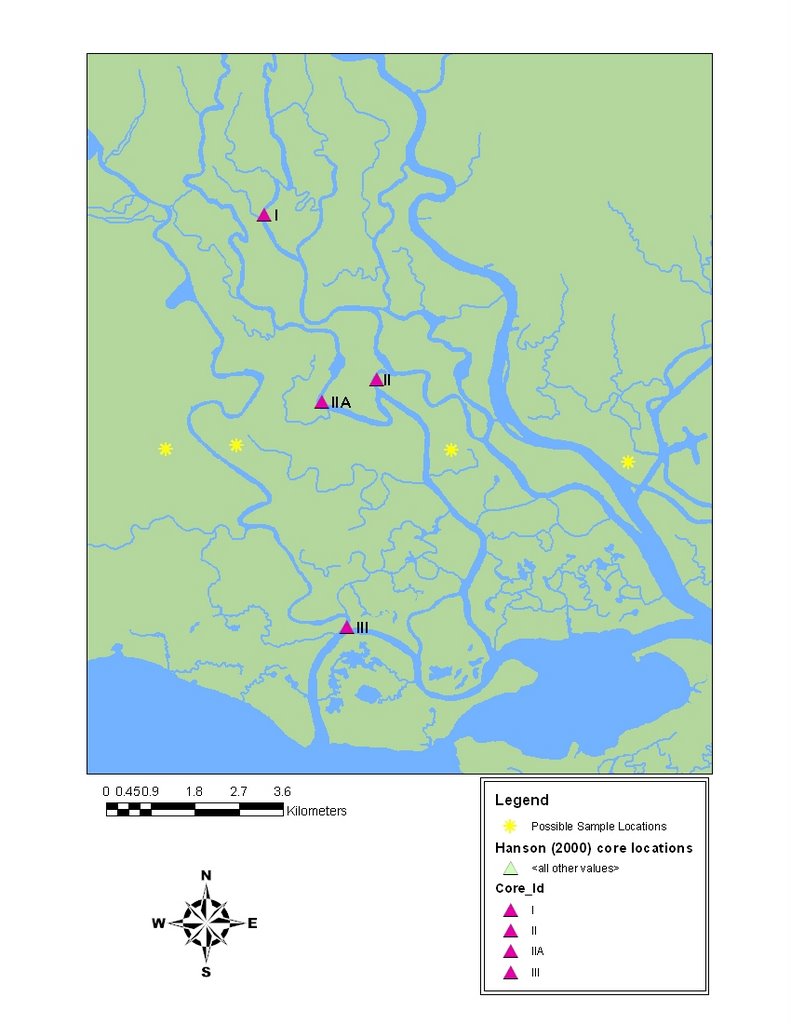 So that is the map I have been working on for like 4 days. Now it should have taken like 10 minutes max, but because my study area is on the border of Mississippi and Louisiana i had to use data from two different states. And of course the data from the two did not match up at all. Mississippi had creeks and rivers that Louisiana did not have, the creeks and rivers that they did both have didnt lign up at all. And it wasn't just a shift, some where shifted up, some down, some i just couldn't figure out at all. And then whomever made these files did a crappy job. The rivers were made up of tiny line segments which some overlapped some came nowhere near the next segment... it was just a mess. So I started from scratch and made the whole thing on my own, in the correct manner using polygons vs tiny line segments. Plus since my computer is not devoted only to ArcMap, it kept freezing every time I saved. Now luckely it would save prior to freezing, so atleast I didn't lose anything! Apparently if i save small little things, vs saving them up for a big save it only freezes every 5th save or so. So progress was made, just slowly. So now it is done, and done properly! My study sites are on there (the yellow stars) georecified like a good map should be :).... I've sent it to Charlotte ... so we will see what she has to say, but I don't see any issues :)..
oh and its one of those days where its thundering so loudly, it feels like the storm is directly on top of you and makes the entire building shake... I am in a secure building, that is supposidly "hurrican proof" and yet it shakes... I hate when it shakes...

2 comments:
Very best site. Keep working. Will return in the near future.
»
Keep up the good work. thnx!
»
Post a Comment